Εμφάνιση αναρτήσεων με ετικέτα Glaciers. Εμφάνιση όλων των αναρτήσεων

Τετάρτη 14 Ιανουαρίου 2015

Sea level rise quickens more than thought in threat to coasts

Sea level rise in the past two decades has accelerated faster than previously thought in a sign of climate change threatening coasts from Florida to Bangladesh, a study said today.
The report, reassessing records from more than 600 tidal gauges, found that readings from 1901-90 had over-estimated the rise in sea levels. Based on revised figures for those years, the acceleration since then was greater than so far assumed.

The report said the earlier readings were incomplete or skewed by local factors such as subsidence.

The new analysis "suggests that the acceleration in the past two decades is 25 percent higher than previously thought," Carling Hay, a Canadian scientist at Harvard University and lead author of the study in the journal Nature, told Reuters.

The study said sea level rise, caused by factors including a thaw of glaciers, averaged about 1.2 millimetres (0.05 inch) a year from 1901-90 - less than past estimates - and leapt to 3 mm a year in the past two decades, apparently linked to a quickening thaw of ice.

Last year, the UN's Intergovernmental Panel on Climate Change (IPCC) estimated the 1901-90 rate at 1.5 mm a year, meaning less of a leap to the recent rate around 3 mm.


The Harvard-led study said the new findings might affect projections of the future pace of sea level rise, especially those based on historical trends.

John Church, a top IPCC author at the Commonwealth Scientific and Industrial Research Organisation in Australia, told Reuters he did not expect any impact on the IPCC's core sea level projections, which are not based on past trends.

IPCC scenarios, which range from a sea level rise of 28 to 98 cms this century, are based on the processes driving sea level change, for instance how ice in Greenland reacts to rising temperatures or the expansion of water as it warms, he said.

Stefan Rahmstorf, of the Potsdam Institute for Climate Impact Research and a world expert in past sea levels, said further analysis was needed to pin down 20th century sea level rise.

The new findings confirm that "sea level is rising and ... the rise has accelerated, with the most recent rates being the highest on record," he told Reuters.

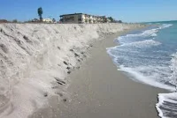
Sea level rise is gnawing away at shores from Miami to Shanghai. In cities such as Jakarta, the rise is aggravated by big local subsidence.
  [buenosairesherald.com]
14/1/15
--
-
Related:

Τρίτη 23 Δεκεμβρίου 2014

China confirms its southern glaciers are disappearing

By Christina Larson, Science Insider
BEIJING—Glaciers in China that are a critical source of water for drinking and irrigation in India are receding fast, according to a new comprehensive inventory. In the short term, retreating glaciers may release greater meltwater, “but it will be exhausted when glaciers disappear under a continuous warming,” says Liu Shiyin, who led the survey for the Cold and Arid Regions Environmental and Engineering Research Institute in Lanzhou.
In 2002, Chinese scientists released the first full inventory of the country’s glaciers, the largest glacial area outside of Antarctica and Greenland. The data came from topographical maps and aerial photographs of western China’s Tibet and Xinjiang regions taken from the 1950s through the 1980s. That record showed a total glacial area of 59,425 square kilometers. The Second Glacier Inventory of China, unveiled here last week, is derived from high-resolution satellite images taken between 2006 and 2010. The data set is freely available online.

Liu and his colleagues calculated China’s total glacial area to be 51,840 square kilometers—13% less than in 2002. That figure is somewhat uncertain because the previous inventory used coarser resolution images that may have mistaken extensive snow cover for permanent ice, says Raymond Bradley, director of the Climate System Research Center at the University of Massachusetts, Amherst, who was not involved in the project.

Methodological quibbles aside, the latest inventory flags a marked retreat of glaciers in the southern and eastern fringes of the Tibetan Plateau. “We found the fastest shrinking glaciers are those in the central upper reach of the Brahmaputra River, between the central north Himalaya [and] the source region of the tributary of the Indus River,” Liu says.

Matthias Huss, a glaciologist at the University of Fribourg in Switzerland, applauds the openness in sharing data, which hasn’t always been the norm in China. “It is highly useful that the colleagues from China have made their data set available to the community. It will feed directly into global efforts to compile a worldwide glacier inventory and is a major improvement,” he says. “It will, for example, greatly support the effort of global glacier modeling to improve our understanding of glaciers’ response to climate change.”
 [tibet.net]
23/12/14

Δευτέρα 15 Σεπτεμβρίου 2014

Glaciers in northern Antarctic Peninsula melting faster than ever despite increased snowfall

An international team of researchers, led by Dr Bethan Davies, from Royal Holloway, University of London, has discovered that small glaciers that end on land around the Antarctic Peninsula are highly vulnerable to slight changes in air temperature and may be at risk of disappearing within 200 years.

Temperatures are currently rising rapidly in the Antarctic Peninsula. Because warmer air holds more moisture, the amount of snowfall has also increased. Some researchers have suggested that this may offset the melting of the glaciers, however this study found that just a small rise in air temperature increased melting so much that even large amounts of extra snowfall could not prevent glacier recession.


"These small glaciers around the edge of the Antarctic Peninsula are likely to contribute most to rising sea levels over the coming decades, because they can respond quickly to climate change," said Dr Davies, from the Department of Geography at Royal Holloway. "This study is the first to show how glaciers in this vulnerable region are likely to respond to climate change in future. Our findings demonstrate that the melting will increase greatly even with a slight rise in temperature, offsetting any benefits from increased snowfall."

The researchers carried out extensive fieldwork on James Ross Island, northern Antarctic Peninsula, to map and analyse the changes to a glacier, which is currently 4km long, over the past 10,000 years. They used a combination of glacier and climate modelling, glacial geology and ice-core data.

Dr Davies added: "Geological evidence from previous studies suggests that the glacier grew by 10km within the last 5,000 years, before shrinking back to its current position. It was argued that this occurred during a warmer but wetter period, suggesting that increased precipitation in the future would offset the melting of the glaciers. However, our study shows that this growth occurred during the colder 'Little Ice Age', reaching its largest size just 300 years ago."

Researcher Dr Nicholas Golledge, from Victoria University of Wellington, in New Zealand, said: "This glacier, though small, is typical of many of the small glaciers that end on land around the Antarctic Peninsula. This research is important, because it helps reduce some of the uncertainties about how these glaciers will react to changing temperature and precipitation over the next two centuries."

Professor Neil Glasser, from Aberystwyth University, added: "We found that this glacier remained roughly the same size for thousands of years until it started to grow again 1,500 years ago. However, it is now melting faster than anything seen before, and over the next 200 years will become far smaller than at any point over the last 10,000 years. This unprecedented glacier recession, in response to climate change, will result in significant contributions to sea level rise from this and similar Antarctic Peninsula mountain glaciers and ice caps."

http://www.sciencedaily.com/releases/2014/09/140914211024.htm?utm_source=feedburner&utm_medium=feed&utm_campaign=Feed%3A+sciencedaily+%28Latest+Science+News+--+ScienceDaily%29
14/9/14
--
-
Related:


Κυριακή 31 Αυγούστου 2014

Iceland issues red alert after new eruption near volcano

Iceland on Sunday raised its aviation alert over its largest volcano to the highest level of red after a new eruption nearby.

The alert entails a ban on all flights below 6,000 feet (1.8 kilometers) within a radius of 10 nautical miles (18.5 kilometer) of Bardarbunga.

"All airports are open. The area has no effect on any airports," the Civil Protection Office said in a statement.

Sunday was the third time in a week that Iceland issued a red alert for aviation due to seismic activity near Bardarbunga.


The latest eruption happened roughly in the same area of another eruption on Friday, the authorities said. Bardarbunga, in the southeast of the country, is Iceland's second-highest peak.

A major explosion at Bardarbunga, located under Europe's largest glacier, could signal a replay of the global travel chaos triggered when another Icelandic peak blew four years ago, unleashing a massive ash cloud across Europe.

Source: AFP - globaltimes.cn
31/8/14 (1/9/14)
--
-
Related:

----

  • M 5.0 - ICELAND - 2014-08-31 12:01:47 UTC


Magnitude    mb 5.0
Region    ICELAND
Date time    2014-08-31 12:01:47.6 UTC
Location    64.71 N ; 17.44 W
Depth    2 km
Distances

    224 km E of Reykjavík, Iceland / pop: 113,906 / local time: 12:01:47.6 2014-08-31
113 km S of Akureyri / pop: 16,563 / local time: 12:01:00.0 2014-08-31 

-----------------------

  • M 4.6 - ICELAND - 2014-08-31 16:12:36 UTC

Magnitude    Mw 4.6
Region    ICELAND
Date time    2014-08-31 16:12:36.5 UTC
Location    64.78 N ; 17.27 W
Depth 

   15 km
Distances    234 km E of Reykjavík, Iceland / pop: 113,906 / local time: 16:12:36.5 2014-08-31
108 km S of Akureyri / pop: 16,563 / local time: 16:12:00.0 2014-08-31 

--------------------------

Κυριακή 24 Αυγούστου 2014

Strong quakes shake Icelandic volcano

Two strong earthquakes on Sunday shook Iceland's largest volcano, which is on orange alert lowered from red one for one day amid fears of an imminent eruption, the Icelandic Met Office said.

A large explosion at the Bardarbunga volcano could signal a replay of the global travel chaos caused by the eruption of another Icelandic peak four years ago, which created a massive ash cloud across Europe.

The earthquakes were listed on the Met Office's website with intensities of 5.3 and 5.1 on the Richter scale, which makes them the strongest recorded in the region since the current seismic cycle began last week.


On Saturday, Iceland raised its alert over the Bardarbunga volcano to the highest level and closed airspace in the area, but all of Iceland's airports remained open.

Met Office official Gunnar Gudmundsson told Icelandic public broadcaster RUV that it was difficult to say whether the earthquakes indicated an increased risk of an eruption.

Police said some 300 people had been evacuated in a popular tourist area located north of the Bardarbunga volcano, which lies in southeast Iceland.

"This is quite an extensive evacuation, but it is only in the canyons themselves, not in the inhabited area," Husavi chief of police Svavar Palsson told local media.

"Most of the people were foreign tourists."

The authorities said they had decided not to evacuate residents of nearby areas, but encouraged them to be alert and have their mobile phones switched on at all times.

Police said that the ice layer in the area was between 150 and 400 meters thick.

  • Local authorities fear floods from melting ice could cause serious damage to the country's infrastructure.
Seismologists had recorded an earthquake of 4.5 on the Richter scale on Monday, when Iceland decided to raise its aviation alert to orange, the second-highest level of five.

The eruption of Eyjafjoell, a smaller volcano, in April 2010 caused travel mayhem, stranding more than 8 million people in the widest airspace shutdown since World War II.

"There's nothing we can do if we get another big eruption like that of Eyjafjoell except to interrupt air traffic in the dangerous areas," Icelandic Civil Aviation Administration spokesman Fridthor Eydal was quoted as saying earlier this week.

"It's really the only thing we can do," he said.

Iceland's most active sub-glacial volcano Grimsvotn erupted in 2011, forcing the country to temporarily shut its airspace and sparking fears of a repeat of the Eyjafjoell flight chaos.

Iceland is home to more than 100 volcanic mountains, some of which are among the most active in the world.

Sources: AFP - globaltimes.cn
24/8/14
---
-
Related:

----

--
 ---

Σάββατο 23 Αυγούστου 2014

Iceland issues aviation alert on volcano activity (M 4.7 - ICELAND - 2014-08-23 18:33:06 UTC.....local time: 18:33)

Iceland's Meteorological Office says a subglacial eruption is underway at the Bardarbunga volcano, which has been rattled by thousands of earthquakes over the past week.

Vulcanologist Melissa Pfeffer said seismic data indicates that lava from the volcano is melting ice beneath the Vatnajokull glacier. She said it was not clear when, or if, the eruption would melt the ice and send steam and ash into the air.

Minutes earlier, Iceland raised its aviation alert for the volcano to the highest level of red on Saturday, indicating an eruption that could cause “significant emission of ash into the atmosphere.” Red is the highest alert warning on a five-point scale.


Scientists had planned to fly over the glacier later Saturday to look for changes on the surface but it was not clear if that would still take place.

Authorities had evacuated several hundred people earlier this week from the highlands north of the Vatnajokull glacier as a precaution. The area is uninhabited but popular with hikers.

Iceland sits on a volcanic hot spot in the Atlantic's mid-oceanic ridge and eruptions have occurred frequently, triggered when the Earth's plates move and when magma from deep underground pushes its way to the surface.

A 2010 eruption of the Eyjafjallajokul volcano produced an ash cloud that caused a week of international aviation chaos, with more than 100,000 flights cancelled. Aviation regulators since have reformed policies about flying through ash, so a new eruption would be unlikely to cause that much disruption.

Pfeffer said the amount of ash produced would depend on the thickness of the ice.

“The thicker the ice, the more water there is, the more explosive it will be and the more ash-rich the eruption will be,” she said.
(AP)

http://www.france24.com/en/20140823-iceland-issues-aviation-alert-volcano-errupts-bardarbunga/
24/8/14
--
-
Related:
----


  • M 4.7 - ICELAND - 2014-08-23 18:33:06 UTC.....local time: 18:33
Magnitude    mb 4.7
Region    ICELAND
Date time    2014-08-23 18:33:06.2 UTC
Location    64.70 N ; 17.48 W
Depth    2 km
Distances    222 km E of Reykjavík, Iceland / pop: 113,906 / local time: 18:33:06.2 2014-08-23
113 km S of Akureyri / pop: 16,563 / local time: 18:33:00.0 2014-08-23 

-------------------------
-

Τετάρτη 20 Αυγούστου 2014

Double threat for Tibet (Climate change and human development are jeopardizing the plateau’s fragile environment.)

The plateau and its surrounding mountains cover 5 million square kilo­metres and hold the largest stock of ice outside the Arctic and Antarctic; the region is thus often referred to as the Third Pole. And like the actual poles, it is increasingly feeling the effects of climate change, but rapid development is putting it doubly at risk, the report says.

Released in Lhasa on 9 August by the Chinese Academy of Sciences (CAS) and the government of Tibet, the assessment aimed to address gaps in knowledge about the extent of the problems the 4,500-metre-high plateau faces. It finds that precipitation has risen by 12% since 1960, and temperatures have soared by 0.4 °C per decade — twice the global average.
In addition, glaciers are shrinking rapidly and one-tenth of the permafrost has thawed in the past decade alone. This means that the number of lakes has grown by 14% since 1970, and more than 80% of them have expanded since, devastating surrounding pastures and communities.
The plateau feeds Asia’s biggest rivers (see ‘Running wild’), so these problems are likely to affect billions of people, the report says. Pollution from human and industrial waste as a result of rapid development is also a serious risk.
But the assessment also suggests ways to combat the problems, calling on the Chinese and Tibetan governments to make conservation and environmental protection top priorities. It will help in the design of “policies for mitigating climate change and striking a balance between development and conservation”, says Meng Deli, Tibet’s vice-chairman.
tibet-map
“The Tibetan plateau is getting warmer and wetter,” says Yao Tandong, director of the CAS Institute of Tibetan Plateau Research in Beijing, who led the assessment. This means that vegetation is expanding to higher elevations and farther north, and growing seasons are getting longer. But some areas, such as the headwater region of Asia’s biggest rivers, have become warmer and drier and are being severely affected by desertification and grassland and wetland degradation.
Human activity, too, is on the rise. The population of the plateau reached 8.8 million in 2012, about three times higher than in 1951. And the number of livestock has more than doubled, putting more strain on grasslands.

Multiple menaces

Growing urbanization is creating more waste than the region can handle. Tibet has the capacity to treat 256,000 tonnes of domestic solid waste a year, less than the amount generated by its two largest cities, Lhasa and Shigatse. “You see a lot of rubbish lying around the plateau, including headwater regions,” says Kang Shichang, a glaciologist at the CAS Institute of Cold and Arid Regions Environmental and Engineering Research Institute in Lanzhou. “It’s an environmental menace.”

A bigger threat comes from mining. According to the assessment, Tibetan mines produced 100 million tonnes of wastewater in 2007 and 18.8 million tonnes of solid waste in 2009. Because most of the mines are open pits and have limited environmental oversight, “air, water and soil pollution is particularly serious”, says the report. Officials release few details about actual pollution levels.

Pollution is coming not just from local sources. Dust, black carbon, heavy metals and other toxic compounds are being blown in from Africa, Europe and southern Asia. The dust and carbon residues are darkening glaciers, making them more susceptible to melting, and the toxic chemicals are poisoning crops, livestock and wildlife.

But the threats from mining and pollution are dwarfed by the potential repercussions of changes in ice and vegetation cover, the assessment says. Different surfaces — snow, grassland, desert — reflect and absorb different amounts of solar radiation, affecting how the air above them is heated. This means that changes in coverage are likely to affect the onset and strength of Asian monsoons. It also has important ramifications for the livelihood of downstream river communities because the glaciers, permafrost and ecosystems act as a giant sponge, helping to control the release of water and prevent floods. “The significance of the assessment goes beyond national borders,” says David Molden, head of the International Centre for Integrated Mountain Development in Kathmandu.

Temperatures in the plateau are projected to rise by between 1.7 °C and 4.6 °C by the end of 2100 compared with the 1996–2005 average, based on the best- and worst-case global-emissions scenarios. So as urbanization and climate change tighten their grip, researchers worry that unbridled development will devastate the plateau’s environment. To protect it, the report says, the central government must evaluate local officials on the basis of their environmental, not just economic, achievements. It must also invest more in ecological compensation, for example by paying herders more to cut their livestock numbers. Moreover, it must be much more open about pollution incidents.

“Tibet will be a test case of how seriously China takes ecological protection,” says Yao. “Safeguarding the plateau environment is crucial not only for sustainable development of the region, but also to social stability and international relations.”
tibet.net
19/8/14
--
-
Related:

Iceland orders evacuation due to possible volcano eruption

The National Commissioner of the Icelandic Police (NCIP) announced on Tuesday that the authorities were evacuating the north of Vatnajokull to prepare against a possible eruption at Bardarbunga volcano in southeast Iceland.

The NCIP said in a statement that it has raised the Civil Protection level to Alert Phase as all roads leading into the area were closed, and the authorities in Husavik and Seydisfjordur were evacuating the area north of Vatnajokull.
A surveillance plane of the Icelandic Coast Guard has been ordered to monitor the volcano's situation.

This decision was a safety measure, said the statement, adding the seismic activity in Bardarbunga might lead to a volcanic eruption.

Bardarbunga volcano, located under the 800-meter-thick Vatnajokull glacier, is 225 km northeast from Reykjavik, capital of Iceland. Bardarbunga is Iceland's second highest mountain at 2,000 meters above sea level.

Since the onset of the earthquake swarm at Bardarbunga on Saturday morning, about 2,600 earthquakes have been detected by the earthquake monitoring network of the Icelandic Meteorological Office (IMO).

IMO has raised the danger level from yellow to orange, which indicates the volcano showed heightened or escalating unrest with increased potential of eruption.
If the volcano erupts, a major flood fed by melting ice from the glacier could be expected to the north, the Icelandic National Broadcasting Service reported.

There have been 48 eruptions in Iceland in last 100 years. The latest huge eruption happened in 2010, when the ash emission from the Eyjafjallajokull volcano forced an air travel disruption in Europe.
By AgenciesX Sources: Xinhua  -globaltimes.cn
20/8/14
--
-
Related:

Τρίτη 19 Αυγούστου 2014

Threat to flights as Iceland's biggest volcano rumbles

REYKJAVIK: Iceland has warned that its largest volcano is in danger of erupting, four years after millions of air travellers were grounded by a huge ash cloud from another peak.
Scientists believe the ash from an eruption at Bardarbunga could disrupt transatlantic and northern European air traffic, with floods of melting ice likely to cause serious damage to the country's infrastructure.
The Icelandic Meteorological Office raised its aviation alert to the second-highest level on Monday after four days of increasing seismic activity, signalling a heightened risk of eruption.

The eruption of Iceland's smaller Eyjafjoell volcano in April 2010 caused global travel chaos, stranding more than eight million travellers as volcanic ash spread across Europe.
The alert was raised to "orange" after seismologists recorded an earthquake of 4.5 on the Richter scale early on Monday, the strongest in the region since 1996. Roads in a sparsely populated area north of Bardarbunga were closed on Tuesday, as the Meteorological Office said it had recorded some 2,600 tremors over the past four days.
Bardarbunga, Iceland's second-highest peak, rises to more than 2,000 metres, caps the country's largest volcanic system. It sits under the vast Vatnajokull glacier, the country's largest, in the southeast of the island, one of the most active seismic areas on the planet.
Bryndis Brandsdottir, a geophysicist at the University of Iceland, told public broadcaster Ruv on Tuesday that the latest readings indicated that magma was not approaching the surface, but rather remaining "three to seven kilometres below".
"We meet twice a day, but the earthquake activity still comes in waves. There do not seem to be any changes, but it is still very powerful," Vidir Reynisson, department manager at Iceland's Civil Protection Department, told broadcaster 365.
In 2010, the Eyjafjoell volcano under the Eyjafjallajokull glacier, further to the south, shot a massive plume of volcanic debris up to nine kilometres into the sky, blowing ash across to mainland Europe. The ash cloud caused the planet's biggest airspace shutdown since World War II, with fears it could damage aircraft engines.
In 2011, Iceland's most active sub-glacial volcano Grimsvotn erupted, forcing Iceland to temporarily shut its airspace amid fears of a repeat of the Eyjafjoell flight chaos.

Παρασκευή 9 Μαΐου 2014

Climate change threatening New Zealand's glacier tourism industry

Global climate change might put an end to tourist trails over New Zealand's iconic South Island glaciers, a geography researcher warned Friday.

The multimillion-dollar glacier tourism industry was under threat with the two main glaciers, Fox and Franz Josef, in rapid retreat, said University of Canterbury researcher Dr Heather Purdie.

"The current glacial retreat is making access increasingly difficult for guided walks at Fox and Franz Josef glaciers but, simultaneously, an enlarging glacial lake at Tasman Glacier is increasing tourism opportunities," Purdie said in a statement.


Steepening ice slopes, increased debris cover and an increase in rock fall hazards were some of the challenges glacier tourism operators faced.

"The termini of the Fox and Franz Josef glaciers are drawing increasingly close to their previous minimum which, coupled with thinning, indicates that retreat will continue for the near future, " said Purdie.

While helicopters and longer tracks up glacier valleys could ensure continued access, these would be financially and environmentally costly, she said.

Glacier tourism had been a part of the New Zealand experience for a century, but access and viewing points would become increasingly unsatisfactory as glaciers retreated into steeper, more inaccessible terrain.

  • Scientists, policy makers and tour operators needed to work together, sharing knowledge, ideas and experience, to find a balance between utilization, safety and conservation, she said.

The Intergovernmental Panel on Climate Change noted that predicted glacier shrinkage and retreat would reduce visitor numbers in towns like Fox Glacier and Franz Josef, but tourism on New Zealand glaciers was as busy as ever, with up to 400 tourists a day last summer

[globaltimes.cn]
9/5/14

Σάββατο 29 Μαρτίου 2014

Ban warns against escalation of crisis in Ukraine, saying ‘small sparks’ could ‘ignite larger flames’. - Visit to Greenland

UN, 28 March 2014 – Reiterating his strong call for a diplomatic solution to the crisis over Ukraine, United Nations Secretary-General Ban Ki-moon this evening warned the concerned parties – and the wider international community – that “at this time of heightened tensions, even small sparks can ignite larger flames of unintended consequences.”

“What started as a crisis in Ukraine, is now also a crisis over Ukraine. From the beginning, my objective has been to seek a peaceful and diplomatic solution to the crisis, in keeping with the fundamental principles of the United Nations Charter,” Mr. Ban told reporters following his briefing to the Security Council on his recent travels.


  • The UN chief, on the road since 20 March, paid official visits to the capitals of both Ukraine and Russia, and also attended Nuclear Security Summit in The Hague, the Netherlands, and visited Greenland’s Ilulissat Icefjord, a UNESCO World Heritage Site.
On the Ukraine crisis, Mr. Ban said he had “strongly urged the Russian and Ukrainian leaders to de-escalate the situation, avoid hasty actions and immediately engage in direct and constructive dialogue to resolve all the problems.”
Answering a reporter’s question on Russia’s intent to send troops into southern and eastern Ukraine, the Secretary-General said President Vladimir Putin assured him that he had no such intention.
“I have been really trying to urge both parties to de-escalate the situation. Emotions were running high, as you will agree, and tensions have been very highly charged. Therefore, my immediate priority was to urge…the leaders of both [countries] to engage in direct dialogue,” said Mr. Ban.
“Now is the time for dialogue and peace,” he stated, adding that the UN will continue its efforts to find a solution to the Crimean crisis through diplomacy and the UN Human Rights Monitoring Mission, which has been on the ground in the region for nearly two weeks.
Mr. Ban expressed concern over the divisions that this crisis in creating among the international community, fearing it could “harm our ability to address other pressing concerns, conflicts and humanitarian emergencies.”
Citing Ukraine, Syria and the Central African Republic as some of the most important issues in need of resolution, the UN chief said: “I have also urged Members of the Security Council to address these issues as soon as possible, because there are so many, much more longer-term issues like the Millennium Development Goals, sustainable development and climate change.” 
----------------------

  • Regarding his visit to Greenland, the Secretary-General said: “I was able to see for myself again the impact of climate change phenomenon. The icebergs and glaciers are melting rapidly.
Having personally been to Antarctica, the North Pole, and Iceland, Mr. Ban noted that Greenland’s Ilulissat Icefjord “is the fastest moving glacier in the world,” and, while he admires the people of Greenland’s ability to live harmoniously with nature, the effects of global warming – melting glaciers, extreme weather patterns and rising sea levels – are starting to “seriously threaten” their livelihoods.
Mr. Ban called on all world leaders to come to his 23 September climate change summit with “strong political will.”
As for the Nuclear Security Summit, the Secretary-General said that he had joined other world leaders in The Hague in highlighting the need for vigilance regarding the risk of nuclear terrorism. “International cooperation will be crucial not only in avoiding the proliferation of nuclear materials, but also in advancing nuclear disarmament – the best guarantee against this threat,” he declared.
[un.org]
28/3/14

Τετάρτη 13 Φεβρουαρίου 2013

Θεαματική κατάρρευση πάγων στην Παταγονία

Στο κατάλληλο μέρος την κατάλληλη στιγμή βρέθηκε ένας ερασιτέχνης φωτογράφος, ο οποίος κατέγραψε την εντυπωσιακή κατάρρευση τμήματος ενός παγετώνα στην Παταγονία με τη φωτογραφική του μηχανή. Δεύτερος αυτόπτης μάρτυρας μαγνητοσκόπησε το συμβάν με το κινητό του τηλέφωνο και ανάρτησε το βίντεο στο Διαδίκτυο.
Σύμφωνα με το Παρατηρητήριο της Γης της NASA, ο Πέριτο Μορένο είναι ένας από τους μεγαλύτερους παγετώνες της Παταγονίας, του νοτιότερου άκρου της Νοτίου Αμερικής, καλύπτοντας έκταση 250 τετραγωνικών χιλιομέτρων! Είναι επίσης ο ένας από τους μόλις 3 παγετώνες της περιοχής που αναπτύσσονται και αποτελεί πόλο έλξης για τους τουρίστες.

Ο συγκεκριμένος έχει την ιδιότητα, καθώς κινείται, να σχηματίζει ένα φυσικό φράγμα που «κόβει» στα δύο τη λίμνη Αρχεντίνο αποτρέποντας τη μεταφορά νερού από το ένα τμήμα στο άλλο.
Η φωτογραφία του Κρίστιαν Γκρόσο και το βίντεο δείχνουν τη στιγμή της κατάρρευσης του φράγματος, στις 19 Ιανουαρίου, παρουσία 20-30 ατόμων, τα οποία δεν βρίσκονταν τόσο κοντά ώστε να κινδυνεύσουν.
Οι ειδικοί του παρατηρητηρίου επισημαίνουν ότι, αν και οπωσδήποτε θεαματική, η κατάρρευση δεν είναι μια από τις μεγαλύτερες που έχουν παρατηρηθεί. Κάθε τέσσερα με πέντε χρόνια, η στάθμη των υδάτων του νοτίου τμήματος της λίμνης, το οποίο αποκόπτεται από το φυσικό φράγμα, ανεβαίνει ακόμη και κατά 30 μέτρα (σε σχέση με την υπόλοιπη λίμνη).
Η πίεση είναι τέτοια που το φράγμα διαλύεται για να σχηματιστεί και πάλι από τον παγετώνα. Οι τελευταίες μεγάλες καταρρεύσεις του αναφέρθηκαν το 2012 και το 2008.
http://www.naftemporiki.gr/story/610312
12/2/13 
----------------------
 La ruptura del puente que une la bahía con el Glaciar se produjo con un tiempo agradable en El Calafate (declared national capital of the glaciers)
Las temperaturas rondaron los 21º y los 27º durante el día y los 5º y 10º por las noches.

Παρασκευή 30 Νοεμβρίου 2012

Polar ice melt 'accelerating'

 
 -----
Glaciers and icebergs are believed to be melting at the fastest rate recorded in decades.
A group of scientists has discovered that polar ice is melting three times faster than it was twenty years ago.

More than 20 polar research teams that have been studying ice in Greenland and Antarctica say the melting is already causing sea levels to rise.
Al Jazeera's Emma Hayward reports.
Source:

30/11/12
 ΣΧΕΤΙΚΑ:

Οι νεκροί Έλληνες στα μακεδονικά χώματα σάς κοιτούν με οργή

«Παριστάνετε τα "καλά παιδιά" ελπίζοντας στη στήριξη του διεθνή παράγοντα για να παραμείνετε στην εξουσία», ήταν η κατηγορία πο...