Εμφάνιση αναρτήσεων με ετικέτα ice sheet. Εμφάνιση όλων των αναρτήσεων

Τρίτη 14 Οκτωβρίου 2014

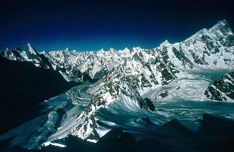
Karakoram Glaciers' Secret Revealed

Although the global warming continues to melt glaciers around the world, the ice mass in the Himalaya’s Karakoram region have been expanding, causing a fuss among the scientific community; however, the mystery has been finally revealed by a recent study published in Nature Geoscience on October 12.

“It has been a source of controversy that these glaciers have not been changing while other glaciers in the world have”, said Sarah Kapnick, a researcher at the Princeton University, as quoted by Discovery News.


The study compared a set of climate model simulations, focusing on seasonal cycles and their roles in the climate change in three regions of the Himalayas, including the Karakoram. Scientists found out that the moisture from seasonal monsoons increases a number of rainfalls in the region. Since the mountains are so high up, the moisture turns into snow, protecting the glaciers from reduction, Live Science said.

Scientists looked at 2,018 glaciers between 2001 and 2011 in the Himalayas and concluded that most of them – 1,700 glaciers – were stable and showed the same surface area and did not change their direction, International Business Times reported.

The Himalayan glaciers form the largest body of ice outside the polar caps. The glaciers store about 12,000 km3 of freshwater, according to International Business Times.

(RIA Novosti)
14/10/14
--

Τετάρτη 20 Αυγούστου 2014

Double threat for Tibet (Climate change and human development are jeopardizing the plateau’s fragile environment.)

The plateau and its surrounding mountains cover 5 million square kilo­metres and hold the largest stock of ice outside the Arctic and Antarctic; the region is thus often referred to as the Third Pole. And like the actual poles, it is increasingly feeling the effects of climate change, but rapid development is putting it doubly at risk, the report says.

Released in Lhasa on 9 August by the Chinese Academy of Sciences (CAS) and the government of Tibet, the assessment aimed to address gaps in knowledge about the extent of the problems the 4,500-metre-high plateau faces. It finds that precipitation has risen by 12% since 1960, and temperatures have soared by 0.4 °C per decade — twice the global average.
In addition, glaciers are shrinking rapidly and one-tenth of the permafrost has thawed in the past decade alone. This means that the number of lakes has grown by 14% since 1970, and more than 80% of them have expanded since, devastating surrounding pastures and communities.
The plateau feeds Asia’s biggest rivers (see ‘Running wild’), so these problems are likely to affect billions of people, the report says. Pollution from human and industrial waste as a result of rapid development is also a serious risk.
But the assessment also suggests ways to combat the problems, calling on the Chinese and Tibetan governments to make conservation and environmental protection top priorities. It will help in the design of “policies for mitigating climate change and striking a balance between development and conservation”, says Meng Deli, Tibet’s vice-chairman.
tibet-map
“The Tibetan plateau is getting warmer and wetter,” says Yao Tandong, director of the CAS Institute of Tibetan Plateau Research in Beijing, who led the assessment. This means that vegetation is expanding to higher elevations and farther north, and growing seasons are getting longer. But some areas, such as the headwater region of Asia’s biggest rivers, have become warmer and drier and are being severely affected by desertification and grassland and wetland degradation.
Human activity, too, is on the rise. The population of the plateau reached 8.8 million in 2012, about three times higher than in 1951. And the number of livestock has more than doubled, putting more strain on grasslands.

Multiple menaces

Growing urbanization is creating more waste than the region can handle. Tibet has the capacity to treat 256,000 tonnes of domestic solid waste a year, less than the amount generated by its two largest cities, Lhasa and Shigatse. “You see a lot of rubbish lying around the plateau, including headwater regions,” says Kang Shichang, a glaciologist at the CAS Institute of Cold and Arid Regions Environmental and Engineering Research Institute in Lanzhou. “It’s an environmental menace.”

A bigger threat comes from mining. According to the assessment, Tibetan mines produced 100 million tonnes of wastewater in 2007 and 18.8 million tonnes of solid waste in 2009. Because most of the mines are open pits and have limited environmental oversight, “air, water and soil pollution is particularly serious”, says the report. Officials release few details about actual pollution levels.

Pollution is coming not just from local sources. Dust, black carbon, heavy metals and other toxic compounds are being blown in from Africa, Europe and southern Asia. The dust and carbon residues are darkening glaciers, making them more susceptible to melting, and the toxic chemicals are poisoning crops, livestock and wildlife.

But the threats from mining and pollution are dwarfed by the potential repercussions of changes in ice and vegetation cover, the assessment says. Different surfaces — snow, grassland, desert — reflect and absorb different amounts of solar radiation, affecting how the air above them is heated. This means that changes in coverage are likely to affect the onset and strength of Asian monsoons. It also has important ramifications for the livelihood of downstream river communities because the glaciers, permafrost and ecosystems act as a giant sponge, helping to control the release of water and prevent floods. “The significance of the assessment goes beyond national borders,” says David Molden, head of the International Centre for Integrated Mountain Development in Kathmandu.

Temperatures in the plateau are projected to rise by between 1.7 °C and 4.6 °C by the end of 2100 compared with the 1996–2005 average, based on the best- and worst-case global-emissions scenarios. So as urbanization and climate change tighten their grip, researchers worry that unbridled development will devastate the plateau’s environment. To protect it, the report says, the central government must evaluate local officials on the basis of their environmental, not just economic, achievements. It must also invest more in ecological compensation, for example by paying herders more to cut their livestock numbers. Moreover, it must be much more open about pollution incidents.

“Tibet will be a test case of how seriously China takes ecological protection,” says Yao. “Safeguarding the plateau environment is crucial not only for sustainable development of the region, but also to social stability and international relations.”
tibet.net
19/8/14
--
-
Related:

Δευτέρα 26 Μαΐου 2014

Greenpeace complaint halts Norway plans to drill northermost oil well

Environmental activists from Greenpeace have blocked plans by Norwegian state-owned oil company Statoil to drill the world’s northernmost oil well, the activists' organization told ITAR-TASS on Monday. Campaigners accuse Statoil of violating the law that bans drilling in ice and near an ice boundary. Russia to apply for Arctic shelf borders in 2015 — minister Sergei Donskoy said.

The halt was called as Transocean operators' Spitsbergen rig made its way towards the site in the Norwegian sector of the Barents Sea. Work is now on hold until a Greenpeace complaint is investigated, said the protest group's press officer, Maria Favorskaya.


Campaigners accuse Statoil of violating the law that bans drilling in ice and near an ice boundary. Norway's Polar Institute had shown the boundary was located just 25 kilometres from Statoil’s licensed area, said Favorskaya.

  • Oil production threatens Medvezhiy Island wildlife sanctuary, where the coast could be fouled by an oil spill reaching it from the exploration site within days, Greenpeace says.
This sanctuary of the Svalbard archipelago has been created to preserve a colony of birds and rare sea mammals, one of the largest refuges in the northern hemisphere.

Activists in the new campaign include some of those arrested by the Russian authorities in a protest against drilling by the Prirazlomnaya oil rig in Russian waters several months ago.

This time, aboard the vessel Esperanza, they have already visited Medvezhiy Island. They are now heading for the planned drilling site to ensure the oil company does not start work until the investigation is completed.
[http://indian.ruvr.ru/news]

26/5/14
--
-
Related:

Κυριακή 17 Νοεμβρίου 2013

Could volcanoes be causing Antarctic ice loss?

AFP - Accelerating ice loss from the Antarctic ice sheet could be due in part to active volcanoes under the frozen continent's eastern part, a study said on Sunday.
From 2002 to 2011, the average annual rate of Antarctic icesheet loss increased from about 30 billion tonnes to about 147 billion tonnes, the UN's panel of climate scientists reported in September.
The icesheet is a mass of glacial land ice -- one such sheet covers most of Greenland and the other Antarctica, and together they contain most of the freshwater on Earth.
The sheets are constantly moving, slowly flowing downhill and seawards under their own weight. Portions that extend out over the water are called ice shelf.

Previous research has blamed warmer seas swirling in a circular fashion around Antarctica for the quicker pace of icesheet loss from the southernmost continent.
These waters erode ice shelves, went the theory. And as more of the shelves disappeared, the quicker the sheet would flow and lose ice to the sea.
But in a new paper in the journal Nature Geoscience geologists led by Amanda Lough at Washington University in St. Louis, Missouri, suggested that, in West Antarctica, the faster flow may be also be due to volcanoes.
These heat the underside of the ice, causing melting that lubricates the flow, they suggested.
Evidence for this comes from recently deployed sensors that recorded two "swarms" of seismic activity under Mary Byrd Land, a highland region of West Antarctica, in 2010 and 2011.
Using ice-penetrating radar, the team found an intriguing elliptically-shaped deposit, measuring about 1,000 square kilometres (386 square miles) in the area, at a depth of 1,400 metres (4,550 feet).
  • The deposit is believed to be volcanic ash, spewed out by an enormous eruption some 8,000 years ago -- an estimate reached on the assumption it has since been covered by ice accumulating at the rate of 12.5 centimetres (five inches) a year.
"Together, these observations provide strong evidence for ongoing magmatic activity and demonstrate that volcanism continues to migrate southwards."
Several volcanoes were known to exist in West Antarctica, but none were thought to be active.
"Eruptions at this site are unlikely to penetrate the 1.2 to two-km (0.75-1.2-mile) -thick overlying ice, but would generate large volumes of melt water that could significantly affect ice stream flow," said the study.
france24.com
17/11/13

Παρασκευή 9 Νοεμβρίου 2012

Enhanced melting of Northern Greenland in a warm climate

Simulated ice thickness for the Greenland ice sheet for the last interglacial period (~126 thousand years before present). This was the most recent period with relatively warm temperatures at high northern latitudes, not unlike what is expected for the 21st century from projections of global warming. Circles show locations with ice core data.
 (Credit: Image courtesy of University of Bergen)

ScienceDaily (Nov. 9, 2012) — In a new study from the Bjerknes Centre for Climate Research, scientists show how the northern part of the Greenland ice sheet might be very vulnerable to a warming climate
The study is based on simulations with a state of the art global climate model and a dynamic ice sheet model of the last interglacial warm period. This period (~126 thousand years before present) is the most recent in Earth's history with temperatures warmer than present in the Arctic region, and has frequently been used as an analogue for a future greenhouse climate. During this period we know that the Greenland ice sheet was significantly reduced in size compared to today.


The model simulations show an extreme retreat of the northern part of the Greenland ice cap in response to the warm interglacial climate, a climate not unlike what we expect on Greenland in the very near future. This result is surprising, as temperatures on the north part of Greenland are colder than in the south. However, increased precipitation compensates for much of the increased melting of the southern part of the ice sheet in a warmer climate.
Today, most scientists expect that the southern part of the Greenland ice sheet is most vulnerable to a changing climate. In particular, there are several studies monitoring ice streams and fjord temperatures along the coast of southern Greenland. However, the new results indicate that the northern part of Greenland, at the fringe of the Arctic Ocean, should be particularly closely. In this area part of the ice sheet is grounded below sea level, and can respond rapidly once it starts receding.
If the Greenland ice sheet were to melt completely, it would result in an increase in mean global sea level by about 7 meters. However, the sea level impact of the observed recent accelerated melt of the ice sheet, as well as future projections of melt from the ice sheet, are not implemented by the current generation of climate models included in the IPCC effort.


Enhanced melting of Northern Greenland in a warm climate
9/11/12

Οι νεκροί Έλληνες στα μακεδονικά χώματα σάς κοιτούν με οργή

«Παριστάνετε τα "καλά παιδιά" ελπίζοντας στη στήριξη του διεθνή παράγοντα για να παραμείνετε στην εξουσία», ήταν η κατηγορία πο...